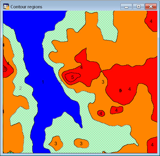
Occurrence
MapInfo Discover 32-bit's Surfaces > Grid Contouring tool produces polylines, but I want the contour ranges to be (enclosed) polygon regions.
Solution
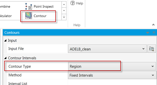
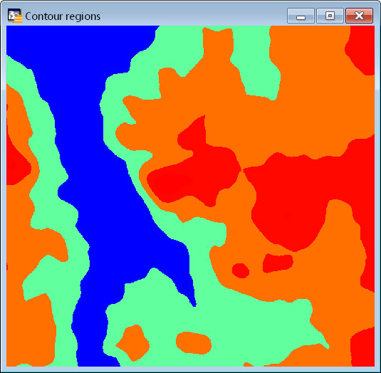
MapInfo Discover 64-bit
The Contour Operation in the new MapInfo Pro Raster can automatically create polygon contours in one step, by setting the 'Contour Type' as 'Region':
MapInfo Discover 32-bit
One of the easiest ways to convert contours to regions in the old Surfaces module, is to generate them using different tools.
To generate regions -
1. Use Surfaces > Grid Utilities > Classify and click the Auto button. Enter the desired number of contour intervals/ranges (via the add/delete/insert rows controls) and their from/to values.
2. After the you are satisfied with the classified ranges, click Save As to create a new grid file.
3. Open this classified grid into the Surfaces > Grid Utilities > Vectorize tool.
4. Select the vectorize mode 'Generate regions of discrete non-null grid values'.
5. Also enable the 3 options in the dialog ('Outline regions', 'Fill regions' and 'Match output...'), and click Save As.
6. The vectorized file will now create the contour polygons.