How do I:
A. Add coordinates to a series of discrete point locations such as proposed regional RAB/aircore drill targets, and then add an incrementing identifier (e.g. HoleID) to each location?
B. Convert a series of proposed regional traverse lines/polylines into grid pegs/sample locations at a fixed spacing, each with coordinates and unique ID's?
C. Create a series of parallel traverse/sample line (i.e. a local grid), with pegs/point locations at fixed spacings, each with both local and real world coordinates, as well as unique ID's?
Solution
A. Add coordinates to a series of discrete point locations such as proposed regional RAB/aircore drill targets, and then add an incrementing identifier (e.g. HoleID) to each location?
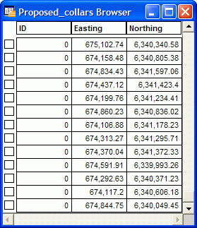
1/. If a series of target locations have been added to say the cosmetic layer as points (e.g. the intersection of regional lineaments/faults with prospective stratigraphy), save these point objects to a new table (Map>Save Cosmetic Objects).
2/. Use Discover's Discover>Projection>Update Coordinates tool to create a new Easting/X and Northing/Y field to this table, and automatically populate these fields with the appropriate values. Note that by default the coordinates will be captured in the Projection of the map window; use the Other Projection option to change the projection the output coordinates will be displayed in.
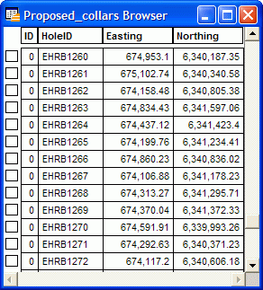
3/. Use Discover's Modify>Update>Unique Identifier to populate each record with an incrementing ID value. See the related article discussing this in detail.
B. Convert a series of proposed regional traverse lines/polylines into grid pegs/sample locations at a fixed spacing, each with coordinates and unique ID's?
1/. If a series of proposed sample traverses have been added to say the cosmetic layer as lines or polylines, save these to a new table (Map>Save Cosmetic Objects).
2/. If each traverse line is to be named, add a new field (Table>Maintenance>Table>Modify Structure, and add say a Character field of 20 width called Line_Name). Attribute each line as necessary. Save these changes (File>Save Table).
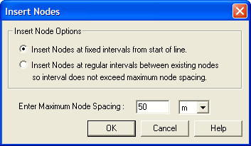
3/. Use the Discover's Modify>Update>Nodes>Insert Nodes tool to insert nodes at the required distance along each traverse line (e.g. 50m). Save these changes (File>Save Table)
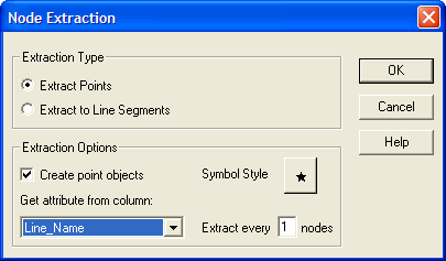
4/. Select all the lines of interest, and run Discover's Modify>Update>Nodes>Extract Nodes tool.
5/. Use Modify>Update>Unique Identifier to populate each record with an incrementing ID value. See the related article discussing this in detail.
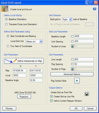
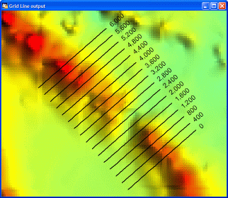
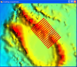
C. Create a series of parallel traverse/sample line (i.e. a local grid), with pegs/point locations at fixed spacings, each with both local and real world coordinates, as well as unqiue ID's?
Use Discover's Analysis>Display>Gridline Planner tool.