To measure the distance between two points, lines or the width of an anomaly use the Distance/Bearing tool located on the Main Toolbar. ![]()
With this button selected simply click on a starting location on the map or cross-section display window and then click again on another location. the pop-up window that appears will display the Distance, Total Distance (for more than two locations) and Azimuth.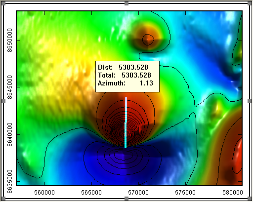
How can I measure the distance betweem two locations on a map or cross-section?


Related Articles
No related articles were found.Attachments
No attachments were found.Last Updated on: 17th of October, 2007