If there is a 2D map displaying multiple layers of vectors, grids, contours, models, etc then this can be saved as a raster image for additional use in Encom PA, such as a draped surface image over a 3D gridded surface.
To create a raster image from a 2D map, highlight the Map branch in the workspace tree and click the right mouse button to display a pop-up menu. select the option to “Save As RGB Raster…” 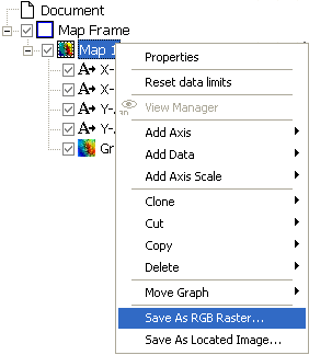
Then specify the Output Resolution of the image and choose between ERMapper (.ERS) or GeoTiff (.TIFF) file format for the raster image.
Once this file has been created it can be draped over a 3D surface using the RGB Surface layer in the Surface Properties of a 3D display window.


